
Here's the short version. From San José, drive to Puntarenas, take the ferry to Paquera, then follow the road through Tambor and Cóbano to the coast: 5½ to 6 hours in total. From Liberia, it's 4½ to 5½ hours south on Route 21 through Nicoya and Paquera. The roads are paved until about 5 km before town; that last stretch and the streets in town are dirt.
How do you drive to Santa Teresa?
Every route ends the same way: at Paquera, on the Gulf side of the Nicoya Peninsula, then about 27 miles (43 km) southwest through Tambor and Cóbano to the crossroads at Playa Carmen. What changes is how you get to Paquera: on the ferry from Puntarenas, or by road around the Gulf of Nicoya over the La Amistad bridge and down Route 21. The three maps below zoom out from the last stretch to the whole country.
The last stretch: Paquera to the coast
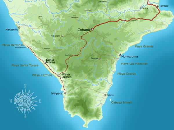
From the Paquera ferry dock, it's about 27 miles (43 km) to the crossroads at Playa Carmen, roughly 1 to 1¼ hours. Turn left for Malpaís or right for Santa Teresa, Playa Hermosa and Manzanillo. Fill up in Cóbano, since there's no gas station in Santa Teresa. The map also shows the road down from Cóbano to Montezuma and Cabuya on the Gulf side.
The Nicoya Peninsula
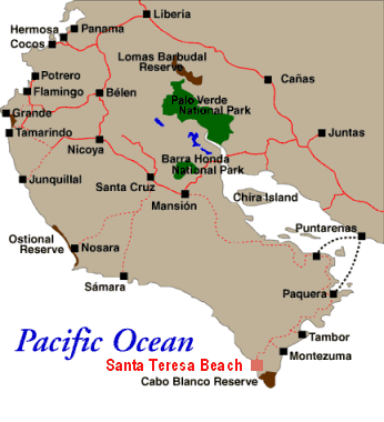
Coming from Liberia or Guanacaste's beaches, stay on paved Route 21 down the east side of the peninsula to Paquera. It's tempting to follow the coast or a GPS shortcut, but those routes use rough back roads with river crossings. The Nicoya Peninsula map has every beach from Santa Teresa north.
Costa Rica
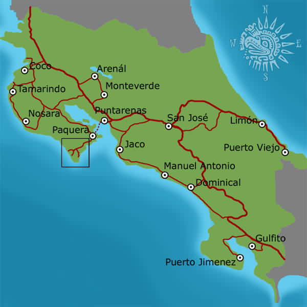
Driving from San José and want to skip the ferry? Head northwest on Route 1, cross the Tempisque River on the La Amistad bridge and take Route 21 south. It takes about 6 to 6½ hours. Step-by-step directions, ferry times and flight options are on our getting to Santa Teresa page.
How long does it take to drive to Santa Teresa?
| From | Route | Distance | Drive time |
|---|---|---|---|
| San José airport (SJO), via the ferry | Route 27 to Puntarenas, ferry to Paquera, then Tambor and Cóbano | 127 mi (205 km) + ferry | 5½–6 h (7 h+ on holiday weekends) |
| San José airport (SJO), by road | Route 1, La Amistad bridge, Route 21 via Jicaral to Paquera, then Cóbano | 184 mi (296 km) | 6–6½ h |
| Liberia airport (LIR) | Route 21 via Santa Cruz, Nicoya and Jicaral to Paquera, then Cóbano | 125 mi (202 km) | 4½–5½ h |
| Tamarindo | Santa Cruz, Nicoya, Route 21 via Jicaral to Paquera, then Cóbano | 121 mi (194 km) | 4½–5 h |
| La Fortuna (Arenal) | To Puntarenas, ferry to Paquera, then Cóbano (or around via La Amistad) | 106 mi (171 km) + ferry | 6–7 h |
| Monteverde | Down to Puntarenas, ferry to Paquera, then Cóbano | 69 mi (111 km) + ferry | 5–5½ h |
| Nosara | Paved loop via Nicoya, Route 21 and Paquera | 117 mi (189 km) | 4½–5 h |
| Nosara, coastal road | Garza, Sámara, Carrillo, Coyote, Manzanillo (dirt, river crossings) | 62 mi (99 km) | 3–4 h+, dry season only |
| Sámara | Paved loop via Nicoya, Route 21 and Paquera | 107 mi (172 km) | 4–4½ h |
| Jacó | To Puntarenas, ferry to Paquera, then Cóbano | 73 mi (117 km) + ferry | 4½–5 h |
| Manuel Antonio | Coast road to Puntarenas, ferry to Paquera, then Cóbano | 113 mi (182 km) + ferry | 6–6½ h |
| Cóbano airport (ACO) | Cóbano, then west to Playa Carmen | 8 mi (13 km) | 25–30 min |
Door-to-door times with a normal ferry wait and a short stop, checked September 23, 2026. Distances are road distances; the ferry crossing adds about 70 minutes. Linked rows open the private transfer page for that route.
What are the roads like?
- The last stretch is dirt. The road from Cóbano is paved and curvy until about 5 km before Malpaís and Santa Teresa, then turns to dirt with seasonal ruts. Paving is under way.
- The town road is gravel. The strip from Malpaís through Playa Carmen and Santa Teresa to Playa Hermosa is mostly gravel and dirt: dusty from December to April, muddy and potholed from May to November, and busy with cars, ATVs and people on foot.
- Gas is in Cóbano. Servicentro Cóbano and Gasolinera Jimal, about 25 to 30 minutes from Playa Carmen. Paquera has a station too.
- Route numbers changed. Google Maps now labels parts of Route 160 (Paquera to Cóbano) as Route 21.
- The coastal road north is seasonal. Santa Teresa to Manzanillo, Coyote, Sámara and Nosara along the coast is mostly dirt with river crossings. It needs a high-clearance 4x4 in the dry season and can be impassable from May to November, and rental insurance doesn't cover water damage from river crossings.
- Drive in daylight. The sun sets between about 5:15 and 6:05 p.m. all year, and the roads into town are rough and poorly lit.
- Route 1 closure. Route 1 at Cambronero, between San Ramón and Esparza, has been closed since September 9, 2026, for up to two months. San José to the Puntarenas ferry via Route 27 still works; check Waze before you set off.
Insider tip: Time your drive around the ferry, not the other way round. Sailings leave Puntarenas at 4:00, 6:30 and 9:00 a.m., noon, 3:00, 6:00, 8:00 and 10:00 p.m., and in high season you want to be in line 1 to 2 hours early. Our Puntarenas ferry page has fares and booking.
Looking for the town map?
The Santa Teresa and Malpaís map shows the coast from Malpaís to Manzanillo: where each beach is, and where to find the banks, supermarkets, pharmacy and clinic.
Rather not drive? Your driver is waiting at arrivals
- Your driver meets you at arrivals, or at your hotel, with a sign bearing your name.
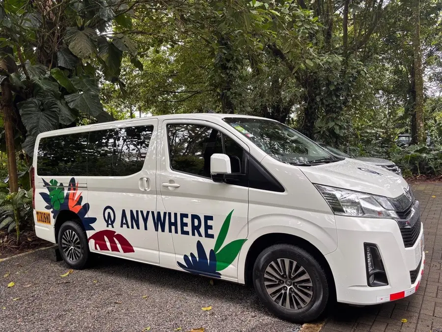
- Safe, friendly, English-speaking drivers with the credentials for tourist transport, arranged by Anywhere Costa Rica (IATA and ASTA accredited).
- Modern, spacious, air-conditioned vans.
- Up to an hour of stops is included: groceries, cold drinks, photos or lunch on the way.
- 24/7 in-country support by phone, text and WhatsApp.
Frequently asked questions
Where is Santa Teresa, Costa Rica? Is it an island?
It's not an island. Santa Teresa is on the Pacific coast near the southern tip of the Nicoya Peninsula, in the province of Puntarenas. It feels remote because the Gulf of Nicoya separates it from the mainland: you reach it by ferry from Puntarenas, by road around the gulf, or by a short flight to Cóbano airport (ACO).
How long is the drive from San José to Santa Teresa?
5½ to 6 hours via the Puntarenas ferry, including a normal wait at the dock, or 6 to 6½ hours around by road over the La Amistad bridge. Allow 7 hours or more on holiday weekends.
How long is the drive from Liberia airport to Santa Teresa?
4½ to 5½ hours, about 125 miles (202 km), all paved except the last stretch. Stay on Route 21 through Nicoya and Jicaral to Paquera; GPS shortcuts through the interior use rough back roads with river crossings.
Do I need a 4x4 to drive to Santa Teresa?
Not on the main road, which is paved until about 5 km before town. Good clearance helps on the dirt stretch and the town road, and a 4x4 is worth it from May to November or if your rental is up a steep hill. You do need a high-clearance 4x4 for the coastal road to Nosara and Sámara, and only in the dry season.
Where is the nearest gas station to Santa Teresa?
In Cóbano, about 8 miles (13 km) and 25 to 30 minutes from Playa Carmen: Servicentro Cóbano and Gasolinera Jimal. There's no gas station in Santa Teresa or Malpaís. Paquera also has one on the way in from the ferry.
Why does Google Maps say Route 21 instead of Route 160?
Google Maps now labels parts of Route 160, the road from Paquera through Tambor to Cóbano, as Route 21. Older and printed maps still call it 160. It's the same road.