
How long is the trip from San José airport (SJO) to Sámara?
| Distance | About 138 miles (222 km) |
|---|---|
| Drive time | About 4½ hours |
| Road surface | Paved and well maintained the whole way, via the La Amistad bridge, Nicoya and Route 150. |
| Ferry | None |
| Private van | From $390 per vehicle |
| Last checked |
Prices are per vehicle for 1 to 6 travelers, taxes included. Groups of 7 or more ride in a larger vehicle.
The drive, stop by stop
- San José airport (SJO) to the Tempisque River: northwest on the Inter-American Highway (Route 1), then west on Route 18 to the La Amistad bridge.
- Across the bridge to Nicoya: onto the Nicoya Peninsula and on to Nicoya, the peninsula's main town.
- Nicoya to Sámara (about 22 miles / 35 km): paved Route 150 down to the coast. Playa Carrillo is just south along the bay. See our Sámara and Carrillo guide.
What to expect on the road
It's the easiest of the long drives from San José: paved, no ferry and no dirt at the end. Land by early afternoon and you'll arrive before dark (the sun sets between about 5:15 and 6:05 p.m. all year). Route 1 at Cambronero, between San Ramón and Esparza, has been closed since September 9, 2026 for up to two months, which can add time until it reopens.
Insider tip: Aim to arrive before dark. Night driving on rural roads is best avoided, and the sun sets between about 5:15 and 6:05 p.m. all year, so a morning or midday landing is the easy plan.
Other private transfer routes
- San José airport (SJO) to Santa Teresa (from $385)
- San José airport (SJO) to Nosara (from $405)
- Santa Teresa to Sámara (from $385)
- Santa Teresa to Tamarindo (from $440)
- Santa Teresa to La Fortuna (Arenal) (from $545)
- Santa Teresa to Monteverde (from $465)
- Santa Teresa to Manuel Antonio (from $385)
- Santa Teresa to Nosara (quote on request)
- Santa Teresa to Jacó (quote on request)
- Cóbano airport (ACO) to Santa Teresa (from $65)
- Cóbano airport (ACO) to Montezuma (from $40)
Compare every way in, including the ferry, flights to Cóbano airport (ACO) and the water taxi, on getting to Santa Teresa, or see all private transfers.
Your driver to Sámara is waiting at arrivals
- Your driver meets you at arrivals, or at your hotel, with a sign bearing your name.
- Safe, friendly, English-speaking drivers with the credentials for tourist transport, arranged by Anywhere Costa Rica (IATA and ASTA accredited).
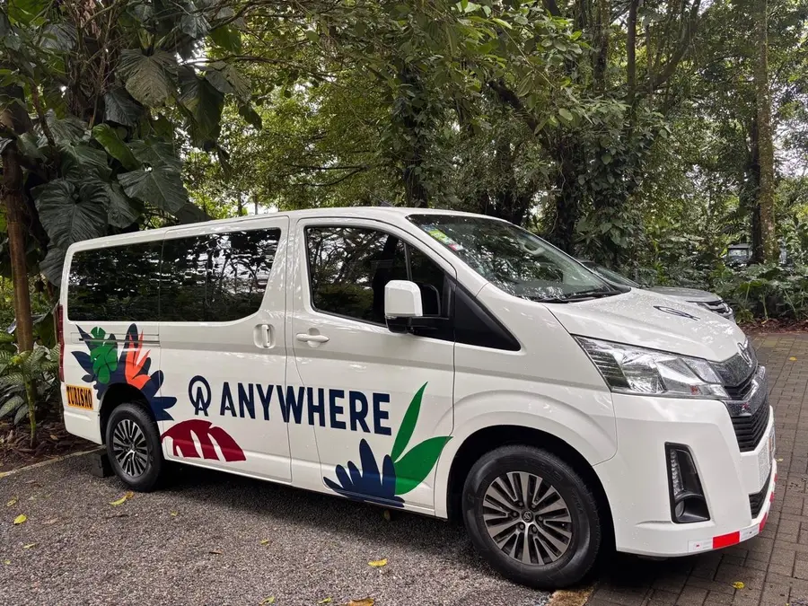
- Modern, spacious, air-conditioned vans.
- Up to an hour of stops is included: groceries, cold drinks, photos or lunch on the way.
- 24/7 in-country support by phone, text and WhatsApp.
Frequently asked questions
How long does it take to get from San José airport (SJO) to Sámara?
About 4½ hours. About 138 miles (222 km). Paved and well maintained the whole way, via the La Amistad bridge, Nicoya and Route 150.
How much is a private transfer from San José airport (SJO) to Sámara?
From $390 per vehicle, for 1 to 6 travelers, taxes included. Enter your date and group size in the box at the top of this page to see the price for your trip.
Is Liberia airport closer to Sámara?
Yes. From Liberia airport (LIR) it's about 105 km, 2 to 2¼ hours, on paved roads via Nicoya. If you can fly into Liberia, it saves more than two hours on the road. There are no scheduled flights to the Sámara/Carrillo airstrip.
Can we stop on the way?
Yes. Up to an hour of stops is included, for groceries, cold drinks, photos or lunch. Just tell your driver.
We're traveling with kids. What about car seats?
Costa Rica's law requires a car seat for children 12 and under who are shorter than 145 cm (57 in) or lighter than 36 kg: rear-facing under 1, forward-facing from 1 to 4, a high-back booster from 4 to 6 and a booster from 6 to 12. Ask about seats when you book, or bring your own if you'd rather use what your kids know.
Where will the driver meet us?
At arrivals, holding a sign with your name. Your driver is English-speaking, with tourist-transport credentials, and our in-country team is on call 24/7 by phone, text and WhatsApp if anything changes.